GeoFill
Put your photos back on the map
Public beta · Mac, iPhone, iPad, and Apple TV on TestFlight
GeoFill finds the photos in your library that have no location — usually the ones from a "real" camera — and works out where they were probably taken, using the geotagged photos you shot around the same time. It proposes; you approve. Nothing is ever written to a photo without an explicit yes, and every change can be undone.
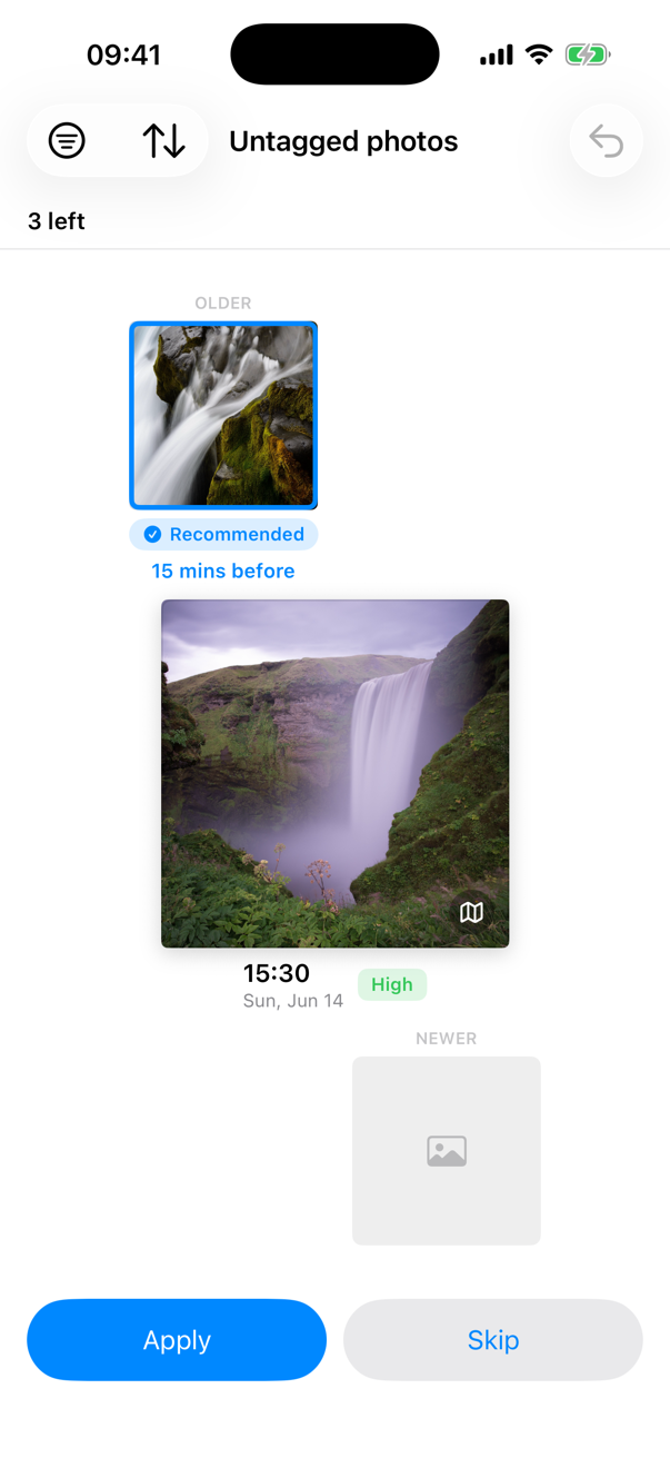
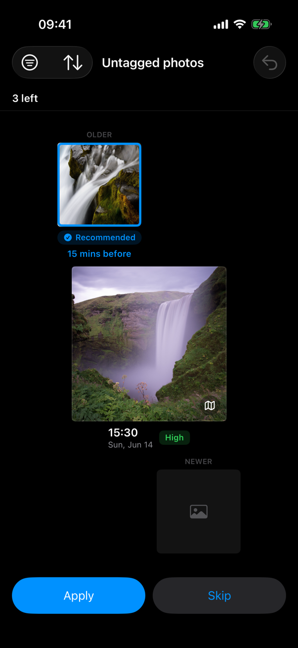
Sample data shown.
Why it exists
If you shoot with both a dedicated camera and an iPhone, your library is split in two: the iPhone shots know where they were taken and the camera shots don't. Maps, Memories, and location search only see half your photos. Filling the gap by hand — look up the timestamp, find a nearby iPhone shot, copy coordinates — is exactly the kind of tedium a computer should be doing.
How it works
For each photo without a location, GeoFill finds the nearest geotagged photos in time — one before, one after, within a two-hour window — and proposes copying the closer neighbour's coordinates, or a time-weighted point between the two. You review each proposal with both photos side by side, approve it with one tap (or swipe, on iPhone), and GeoFill keeps a record of everything it filled in. On the Mac and iPad, the review happens on the map itself: the geotagged photos you took before and after appear as big photo pins at the places they were taken, the photo that needs a location floats alongside, and choosing is just clicking the photo you trust — the map always zooms out so every photo stays in view. A thumbnail strip along the bottom walks you through the queue — tap any photo in it to jump straight there — entirely from the keyboard on the Mac if you like. And when a photo turns out to be one you'd rather not keep at all, Delete sits right beside Apply and Skip: Photos asks you to confirm, and the photo stays recoverable in Recently Deleted for thirty days. On iPhone it's a card deck you can work through in spare moments; on Apple TV the same deck stretches across the big screen, neighbours to either side, and you file each photo with a flick of the Siri Remote. On iPhone, iPad, and Mac, your skips, applied history, and settings sync privately through your own iCloud, so a photo you've dealt with on one device stays dealt with on the others.
Built to see nothing else
GeoFill works entirely on your device, through Apple's Photos framework. Your photos never leave your library; the only thing that travels is your own review history, syncing between your devices through your own iCloud — and there's a toggle in Settings if you'd rather it didn't. No servers of mine, no accounts, no analytics, no third-party code. See the privacy policy — it's short.
Requirements
macOS 14 or later, iOS or iPadOS 17 or later, or an Apple TV running tvOS 17 or later. Full Photos library access (it can't propose locations for photos it can't see).
Get it
GeoFill is now in public beta everywhere it runs — on iPhone and iPad, on Apple TV, and on the Mac, GeoFill's original home — join the beta on TestFlight: install Apple's TestFlight app, open the link on your device, and start putting photos back on the map. Joining once covers all your devices; after you accept, GeoFill also shows up in the TestFlight app on your Mac and Apple TV. Email geofill [at] mattmanuel [dot] com if you'd like a nudge when it ships to the App Store proper.